


NAZARETH WD 02, Northampton County, Pennsylvania
About
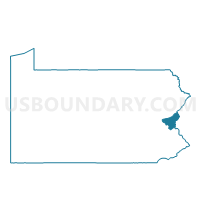
Outline

Summary
| Unique Area Identifier | 661738 |
| Name | NAZARETH WD 02 |
| County | Northampton County |
| State | Pennsylvania |
| Area (square miles) | 0.26 |
| Land Area (square miles) | 0.26 |
| Water Area (square miles) | 0.00 |
| % of Land Area | 100.00 |
| % of Water Area | 0.00 |
| Latitude of the Internal Point | 40.74031600 |
| Longtitude of the Internal Point | -75.30769690 |
Maps


Graphs
Select a template below for downloading or customizing gragh for NAZARETH WD 02, Northampton County, Pennsylvania


Neighbors
Neighoring Voting District (by Name) Neighboring Voting District on the Map
- NAZARETH WD 01, Northampton County, PA
- NAZARETH WD 03, Northampton County, PA
- UPPER NAZARETH TWP VTD EAST, Northampton County, PA
Top 10 Neighboring County Subdivision (by Population) Neighboring County Subdivision on the Map
- Upper Nazareth township, Northampton County, PA (6,231)
- Nazareth borough, Northampton County, PA (5,746)